Search Results 14557 items were found.
Keywords: Landowners.
-
- Item 68913
-

- Scarborough landowners, ca. 1800
- Contributed by: Maine Historical Society
- Date: circa 1800
- Media: Ink on paper
- Buy
-
- Item 102767
-

- Copy of a plan of lands on the west side of Madomack River, Waldoboro, 1774
- Contributed by: Maine Historical Society
- Date: 1774
- Media: Ink on paper
- Buy
-
- Item 108959
-

- Plat of a tract of land in Woolwich, 1751
- Contributed by: Patten Free Library
- Date: 1751-11-29
- Media: Watercolor on paper
- Buy
-
- Item 5320
-

- Peletiah Haly's lot, Haly's Island, ca. 1750
- Contributed by: Maine Historical Society
- Date: circa 1750
- Media: Ink on paper
- Buy
-
- Item 7311
-

- Ferdinand Gorges' land deed to Thomas Cammock, 1634
- Contributed by: Maine Historical Society
- Date: 1634-05-01
- Media: Ink on paper
- Buy
-
- Item 12855
-

- Plan of Cumberland and Lincoln counties, 1773
- Contributed by: Maine Historical Society
- Date: 1773
- Media: Ink on paper
- Buy
-
- Item 12851
-

- Kennebec River, June 1798
- Contributed by: Maine Historical Society
- Date: 1798
- Media: Ink on paper
- Buy
-
- Item 4316
-

- Plan of J. Robinson lot, Topsham, 1761
- Contributed by: Maine Historical Society
- Date: 1761
- Media: Ink on paper
- Buy
-
- Item 12852
-

- Kennebec River above Fort Western, ca. 1800
- Contributed by: Maine Historical Society
- Date: circa 1800
- Media: Ink on paper
- Buy
-
- Item 12560
-

- Plan of lots on Sheepscot Pond, Palermo, 1806
- Contributed by: Maine Historical Society
- Date: 1806-06-27
- Media: Ink on paper
- Buy
-
- Item 68866
-

- Libby River land, Scarborough, 1794
- Contributed by: Maine Historical Society
- Date: 1794
- Media: Ink on paper, map
- Buy
-
- Item 58323
-

- Copy of Surry and Ellsworth map, ca. 1880
- Contributed by: Maine Historical Society
- Date: circa 1880
- Media: Ink on paper
- Buy
-
- Item 5960
-

- Fort land for William Ross, Brunswick, ca. 1763
- Contributed by: Maine Historical Society
- Date: circa 1763
- Media: Ink on paper
- Buy
-
- Item 11720
-

- Middle Bay, Brunswick, 1740
- Contributed by: Maine Historical Society
- Date: 1740-09-29
- Media: Ink on paper
- Buy
-
- Item 11725
-

- Map of Brunswick, 1772
- Contributed by: Maine Historical Society
- Date: 1772
- Media: Ink on paper
- Buy
-
- Item 11727
-

- Cathance Millright's land, Topsham, 1759
- Contributed by: Maine Historical Society
- Date: 1759-06-16
- Media: Ink on paper
- Buy
-
- Item 11729
-

- Land surveyed for Hugh Wilson, Topsham, 1761
- Contributed by: Maine Historical Society
- Date: 1761-01-01
- Media: Ink on paper
- Buy
-
- Item 11730
-

- Map of Topsham, 1761
- Contributed by: Maine Historical Society
- Date: 1761-11-12
- Media: Ink on paper
- Buy
-
- Item 11731
-

- William Patten's lot, Topsham, 1761
- Contributed by: Maine Historical Society
- Date: 1761-11-24
- Media: Ink on paper
- Buy
-
- Item 11732
-

- Map of Topsham, ca. 1760
- Contributed by: Maine Historical Society
- Date: circa 1760
- Media: Ink on paper
- Buy
-
- Item 102071
-

- Map of early Greene, Lewiston and Sabattus, ca. 1790
- Contributed by: Maine Historical Society
- Date: circa 1790
- Media: Ink on vellum
- Buy
-
- Item 20784
-
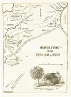
- Black Point, Scarborough, ca. 1633 - 1728
- Contributed by: Maine Historical Society
- Date: circa 1633
- Media: Ink on paper, map
- Buy
-
- Item 68870
-

- Lower part of Scarborough, ca. 1740
- Contributed by: Maine Historical Society
- Date: circa 1740
- Media: Ink and wash on paper
- Buy
-
- Item 35621
-

- Stoneham, ca. 1792
- Contributed by: Maine Historical Society
- Date: circa 1792
- Media: Ink on fabric
- Buy