Search Results 429 items were found.
Category: Nature & Geography, Maps
-
- Item 11828
-

- Exploring survey, St. Croix River to Great Waggansis, 1817
- Contributed by: Maine Historical Society
- Date: 1817
- Media: Ink on paper
-
Buy


-
- Item 11960
-

- Plan of land on Bramhall Hill by Peleg Wadsworth, ca. 1800
- Contributed by: City of Portland Dept. of Public Works
- Date: circa 1800
- Location: Portland
- Media: Ink and wash on paper, map
-
Buy
-
- Item 11964
-

- Map of the City and Harbor of Portland, 1870
- Contributed by: City of Portland Dept. of Public Works
- Date: 1870
- Location: Portland
- Media: Ink on paper, map
-
Buy
-
- Item 11966
-

- Filling Back Cove, Portland, 1837-2003
- Contributed by: City of Portland Dept. of Public Works
- Date: 1837
- Location: Portland
- Media: Ink on paper, map
-
Buy
-
- Item 11967
-

- Back Cove fill history, Portland, 1837-2003
- Contributed by: City of Portland Dept. of Public Works
- Date: 2003
- Location: Portland
- Media: Ink on paper, map
-
Buy
-
- Item 11968
-

- Filling in Back Cove, Portland, part 2, 1837-2003
- Contributed by: City of Portland Dept. of Public Works
- Date: 1837–2003
- Location: Portland
- Media: Ink on paper
-
Buy
-
- Item 11973
-

- Peletiah Haley's island, 1767
- Contributed by: Maine Historical Society
- Date: 1767-10-17
- Location: Topsham; Brunswick
- Media: Ink on paper
-
Buy
-
- Item 11976
-

- Plan of the Kennebec River describing the Plymouth patent, ca. 1719
- Contributed by: Maine Historical Society
- Date: circa 1719
- Media: Ink on paper
-
Buy
-
- Item 11977
-

- Plan of part of the Eastern Shore, 1753
- Contributed by: Maine Historical Society
- Date: 1753
- Media: Ink on paper
-
Buy
-
- Item 12125
-

- Map of Cobbosseecontee Stream, 1765
- Contributed by: Maine Historical Society
- Date: 1765-07-29
- Location: Augusta; Gardiner; Farmingdale; Hallowell; Litchfield; Manchester; Winthrop; Monmouth
- Media: Ink on paper
-
Buy
-
- Item 12126
-

- Kennebec and Sagadahoc Rivers, 1755
- Contributed by: Maine Historical Society
- Date: 1754
- Media: Ink on paper
-
Buy
-
- Item 12199
-

- Plan of Cathance River, Bowdoinham, ca. 1740
- Contributed by: Maine Historical Society
- Date: circa 1740
- Location: Bowdoinham
- Media: Ink on paper
-
Buy
-
- Item 12200
-

- Maps of lots on the Androscoggin River, ca. 1760
- Contributed by: Maine Historical Society
- Date: circa 1760
- Location: Jay; Canton; Livermore Falls
- Media: Ink on paper
-
Buy
-
- Item 12203
-

- Benjamin and Nehemiah Turner's plan containing 200 acres, Palermo, 1806
- Contributed by: Maine Historical Society
- Date: 1806-06-18
- Location: Palermo
- Media: Ink on paper
-
Buy
-
- Item 12382
-

- Plan of Kennebeck River, ca. 1765
- Contributed by: Maine Historical Society
- Date: circa 1765
- Media: Ink on paper
-
Buy
-
- Item 12399
-

- Map of Draper's Claim, near Bath, 1795
- Contributed by: Maine Historical Society
- Date: 1795
- Media: Ink on paper
-
Buy
-
- Item 12400
-

- Draper's claim northeast of Bath, 1795
- Contributed by: Maine Historical Society
- Date: 1795
- Media: Ink on paper
-
Buy
-
- Item 12851
-

- Kennebec River, June 1798
- Contributed by: Maine Historical Society
- Date: 1798
- Media: Ink on paper
-
Buy
-
- Item 12852
-

- Kennebec River above Fort Western, ca. 1800
- Contributed by: Maine Historical Society
- Date: circa 1800
- Media: Ink on paper
-
Buy
-
- Item 12886
-

- James Bowdoin's property, Lisbon, ca. 1770
- Contributed by: Maine Historical Society
- Date: circa 1770
- Location: Lewiston; Lisbon
- Media: Ink on paper
-
Buy
-
- Item 12943
-

- Plan of lots on the Sheepscot River, Alna, 1798
- Contributed by: Maine Historical Society
- Date: 1759
- Location: Alna
- Media: Ink on paper
-
Buy
-
- Item 13074
-

- Manuscript map of Kennebec River area, 1771
- Contributed by: Maine Historical Society
- Date: 1771
- Media: Ink on paper
-
Buy
-
- Item 20784
-
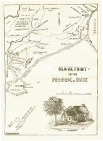
- Black Point, Scarborough, ca. 1633 - 1728
- Contributed by: Maine Historical Society
- Date: circa 1633
- Location: Scarborough
- Media: Ink on paper, map
-
Buy
-
- Item 21566
-

- Map of North Yarmouth, 1687
- Contributed by: Maine Historical Society
- Date: 1687
- Location: North Yarmouth
- Media: Ink on paper
-
Buy