Search Results 263 items were found.
Keywords: town maps
-
- Item 11743
-

- Map of Harpswell, 1742
- Contributed by: Maine Historical Society
- Date: 1742-11-12
- Location: Harpswell
- Media: Ink on paper
-
Buy


-
- Item 12396
-

- Androscoggin River area map, 1771
- Contributed by: Maine Historical Society
- Date: 1771-06-11
- Location: Jay; Canton; Livermore Falls
- Media: Ink on paper
-
Buy
-
- Item 108835
-

- Plan of lots 1-10, Fairfield, 1782
- Contributed by: Maine Historical Society
- Date: 1782-12-20
- Location: Fairfield
- Media: Ink on paper
-
Buy
-
- Item 35628
-

- Map of 1866 Portland Fire, 1866
- Contributed by: Maine Historical Society
- Date: 1866-07-04
- Location: Portland
- Media: Ink on paper
-
Buy
-
- Item 110936
-

- Map of Campobello Island, ca. 1840
- Contributed by: Maine Historical Society
- Date: circa 1840
- Location: Campobello Island
- Media: Ink on paper
-
Buy
-
- Item 71163
-

- Livermore Falls bird's-eye view, 1889
- Contributed by: Boston Public Library
- Date: 1889
- Location: Livermore Falls
- Media: Ink on paper, lithograph
-
Buy
-
- Item 35622
-

- Plan of Lovell, 1871
- Contributed by: Maine Historical Society
- Date: 1871
- Location: Lovell
- Media: Ink on paper
-
Buy
-
- Item 68865
-

- Scarborough map copy, 1784
- Contributed by: Maine Historical Society
- Date: 1784
- Location: Scarborough
- Media: Ink on paper
-
Buy
-
- Item 108848
-

- Map and petition, Sandy River, 1798
- Contributed by: Maine Historical Society
- Date: 1798
- Location: New Vineyard; Farmington
- Media: Ink on paper
-
Buy
-
- Item 35627
-

- Map of Evergreen Cemetery, Portland, 1868
- Contributed by: Maine Historical Society
- Date: 1868
- Location: Portland
- Media: Ink on paper
-
Buy
-
- Item 11724
-

- Map of Brunswick near the Narrows, 1737
- Contributed by: Maine Historical Society
- Date: 1737
- Location: Brunswick; Topsham
- Media: Ink on paper
-
Buy
-
- Item 71155
-

- View of Bridgton, 1888
- Contributed by: Boston Public Library
- Date: 1888
- Location: Bridgton
- Media: Ink on paper, lithograph
-
Buy
-
- Item 10762
-

- Enclosure map, Stroudwater, 1756
- Contributed by: Maine Historical Society
- Date: 1756
- Location: Portland; Westbrook
- Media: Ink on paper
-
Buy
-
- Item 109025
-

- Manuscript map of Topsham Lots, 1763
- Contributed by: Maine Historical Society
- Date: 1763
- Location: Topsham
- Media: Ink on paper
-
Buy
-
- Item 4317
-

- Cathance Mill lots, Topsham, 1759
- Contributed by: Maine Historical Society
- Date: 1759-01-05
- Location: Topsham
- Media: Ink on paper
-
Buy
-
- Item 71169
-

- Bird's-eye view of Springvale, 1888
- Contributed by: Boston Public Library
- Date: 1888
- Location: Sanford
- Media: Ink on paper
-
Buy
-
- Item 71154
-

- Bird's-eye view of Boothbay Harbor, 1885
- Contributed by: Boston Public Library
- Date: 1885
- Location: Boothbay Harbor
- Media: Ink on paper, lithograph
-
Buy
-
- Item 102071
-

- Map of early Greene, Lewiston and Sabattus, ca. 1790
- Contributed by: Maine Historical Society
- Date: circa 1790
- Location: Sabattus; Greene
- Media: Ink on vellum
-
Buy
-
- Item 12395
-

- Map of Wesserunsett stream, 1790
- Contributed by: Maine Historical Society
- Date: 1790-12-12
- Location: Canaan; Canaan
- Media: Ink on paper
-
Buy
-
- Item 10545
-
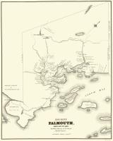
- Map of Ancient Falmouth from 1630 to 1690
- Contributed by: Maine Historical Society
- Date: circa 1630
- Location: Portland
- Media: Ink on paper
-
Buy
-
- Item 100213
-

- Plan of Longfellow and Preble lots, Portland, 1838
- Contributed by: Maine Historical Society
- Date: 1838
- Location: Portland
- Media: Pencil on paper
-
Buy
-
- Item 5335
-

- Brunswick and Topsham, ca. 1730
- Contributed by: Maine Historical Society
- Date: circa 1730
- Location: Brunswick; Topsham
- Media: Ink on paper
-
Buy
-
- Item 35631
-

- Map of the city of Portsmouth, New Hampshire, 1850
- Contributed by: Maine Historical Society
- Date: 1850
- Location: Portsmouth; Kittery
- Media: Ink on paper
-
Buy
-
- Item 22214
-

- Map of Caribou, ca. 1870
- Contributed by: Aroostook County Historical and Art Museum
- Date: circa 1870
- Location: Caribou
- Media: Ink on paper
-
Buy